7. Changes Of Contour
Wonderful changes have taken place in the contour of the greater Fall at Niagara since Docteur Gendron recorded that the Indians traded in those "Erie Stones." The additional Fall, which Father Hennepin pictured in 1697, as pouring eastward from the Canadian end of the Horse Shoe Fall, was formed by the waters flowing around a large rock, which stood at the very edge of the cliff. Before the middle of the 18th Century that rock had disintegrated and been swept away; and that separate Fall then merged itself into the greater cascade; as is shown in a view of Niagara accompanying Peter Kalm's description thereof in 1751. But it must be remembered that in Hennepin's time that Canadian end of the Horse Shoe Fall extended very much farther down the Gorge than it does to-day--probably 800 feet farther. That Fall then extended its shallow end down to where old Table Rock stood. Then the levels of all the upper lakes were higher than they are to-day, those levels having been considerably lowered through the white man's denudations of the forests in the Basin of the Great Lakes. As the downpour of Niagara thereby diminished in volume, that end of the Canadian Fall receded; so that, as far as can be deduced, that Fall was some 400 feet shorter in contour (all taken off its western end) in 1900 than it was when Hennepin saw it--two and a quarter centuries before. Since 1900, the policy of the Province of Ontario, to turn its share of Niagara into cash--in renting out to corporations the right to use the waters of the Cataract for the development of electrical horsepower ("at so much per")--has resulted in still further shortening the contour of the Horse Shoe Fall, by another 400 feet. The contour of that Fall was given by survey in 1840 as 3,060 feet. Hence, in Hennepin's time, it must have been about 3,500 feet. To-day, owing to the filling in of the old river-bed, along the edge of the precipice at the Cataract's western end, that contour line would not be more than 2,700 feet.
But it must be recalled that the recession at the apex of that Fall has been very marked since 1840; and as that recession is V shaped it has added somewhat--fully two hundred feet--to the figures of that old contour line; making the contour line of the Falls to-day about 2,900 feet.
By reason of that shortening of that Fall, two scientific questions are brought up in regard to those deposits of gypsum, or "Petrified Spray of the Falls."
First--to what extent has that concretion formed behind the falling water? Has it formed there in greater quantities than it has where the face of the cliff has been open to the air? In greater quantities might have been expected, on account of the greater amount and absolute continuity of the moisture on the rocky face. The 400 feet length of cliff, from which the waters have now been permanently shut off, furnishes the answer. Practically, none of that concrete has ever accumulated in the crevices of the rock on the face of the cliff immediately behind the Falls. The currents of air, and the furious blasts of water which they create, rush constantly away from the under surface of the falling sheet, and continuously against the face of the cliff. These scour and cut away the rock, even as a sand blast would do, though more slowly. They allow no chance for deposits. The strata of the Clinton Formation (which commences at about the level of the water in the Gorge, and of the Niagara shale, which overlie it--the two combined having a depth of about eighty feet) are eaten away the faster. The eighty-feet-deep layer of Niagara Limestone, which overlies the shale, being harder, is eaten away slowly; its lower layers being attacked by the winds and waters from below (as the underlying shale disappears) and also on its face, yielding faster than the upper ones.
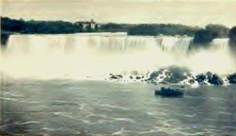 AMERICAN FALL--NIAGARA. CAVE OF THE WINDS IS BEHIND SMALL FALL
That this concretion has always formed in the limestone, back from the face of the cliff, behind the falling sheet (where the blasts of wind and water cannot reach nor effect it) is certain.
That it forms under the river bed, and back from the face of the gorge on both sides of the river, and wherever the water percolates through the upper layer of rock, is also certain.
It is so found in the limestone (but not in the shale) wherever deep excavations have been made near the river in the vicinity of the Falls and wherever tunnels have been driven through the limestone--in the crevices and especially where a pocket or hollow space exists in that formation.
This process of eating away the lower rocks, undermining the upper limestone, which, as its support is taken away, tumbles into the Gorge, shows the means by which the Falls gradually recede.
It is shown to the best advantage in the Cave of the Winds, which, during the past thirty years, by this wind-and-water-blast process, has been enlarged to four times its former size. Some day the layer of rock at the top of that cave will fall; the edge of the Luna Island Fall will be thus moved back a number of feet; the Cave of the Winds will become merely a narrow space between the outward-curving fall of water and the perpendicular rock; and the wind-and-water-blast will continue its erosive work on that rocky face;--and in the course of years will again produce a distinct cave.
The other scientific question--which the future will answer--is, How fast does this Niagara concrete form? With that 400 feet length of cliff on the Canadian shore--which was formerly covered by the end of the Horse-shoe Fall--exposed to the air and to observation (the outer end of those crevices in its face being now free from any such deposit); with the extensive excavations on the debris slope for the Power House below the bank, exposing new surfaces, where little such deposit now appears; with other probable excavations in connection with the power development, exposing similar surfaces at other points along the Gorge; it will be possible to approximately determine the yearly amount of accumulation and deposit of this ancient Niagara product. For that deposit will go on as ceaselessly as it has been going on, ever since the time--possibly many thousands of years ago--when the waters of a great lake (which was formed by the melting of the ice sheet) covered all this region; finally breaking over its northern barrier at the Lewiston escarpment, where, seven miles from its present location, Niagara was born.